Ghost Roads and Remnants of its Glorious Past
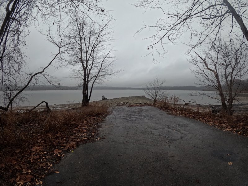
As you hike through East Fork, you’ll notice the rusty, worn-out pasture fences that create a tangled backdrop beside the trails. Old stones, now weathered and broken, once formed the foundations of homes that held stories of families who lived here like the Pinkhams, one of the founding families with a large historic farm. The remnants of roads once passing homes long-gone stop abruptly at the edge of the lake. If you look across the expanse of water, you can see where these roads begin again and were once headed. These haunting reminders of a bygone era invite us to remember the vibrant communities that once thrived here, offering us a glimpse into the lives of those who have long since departed from this serene place.
In the 1970s, the U.S. Army Corps of Engineers undertook the construction of a dam along the East Fork of the Little Miami River. The project was met with controversy, as officials cited public recreation and flood control as the primary objectives. As a result, 253 families were forced to leave their homes, which were abandoned or destroyed by the government around Elk Lick and Bantam. The remains can still be found amidst the brush. The lasting impact of this situation serves as a haunting reminder for many who lived in these communities and for generations to come, even as time passes. However, in the areas of forestland that nature has not overtaken, a mysterious world filled with hidden treasures from the past has emerged, allowing hikers to connect with history. This landscape has become a poignant and eerie reminder of those who lived, loved, and died there.
Parking
Antibantam Trailhead
2787 Williamsburg-Bantam Road
Bethel, OH 45106
(39.005126, -84.113511)
The Hike
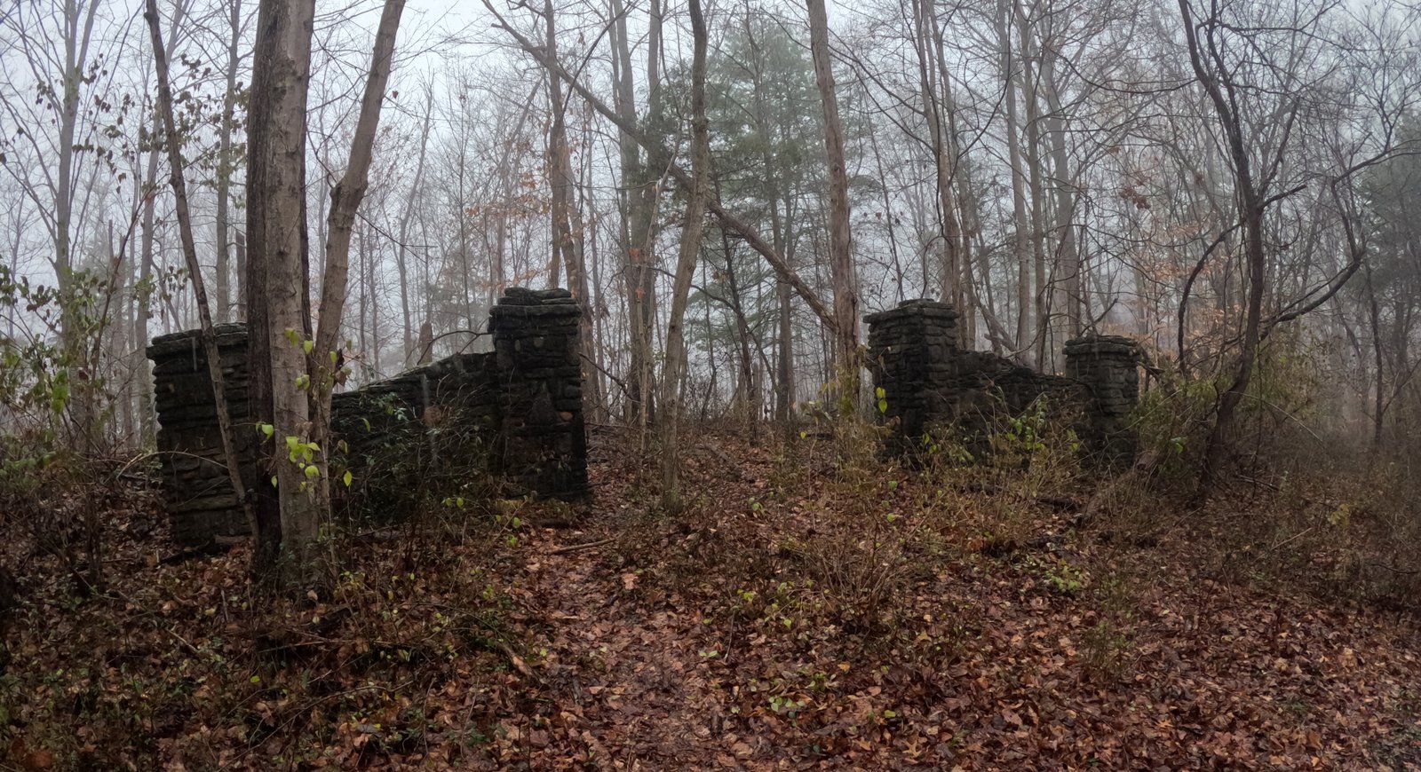
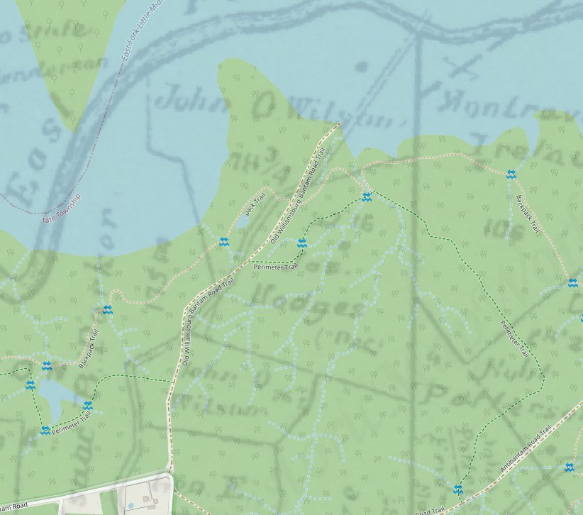
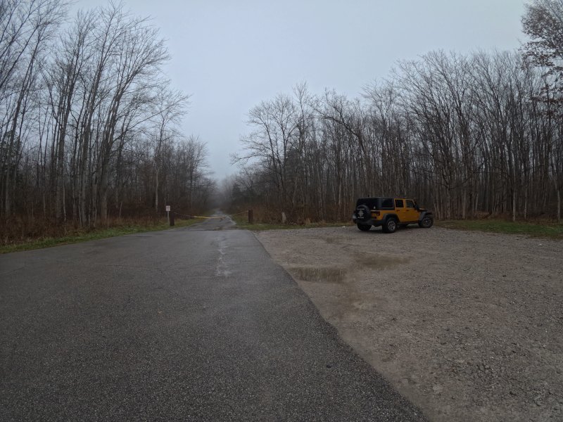
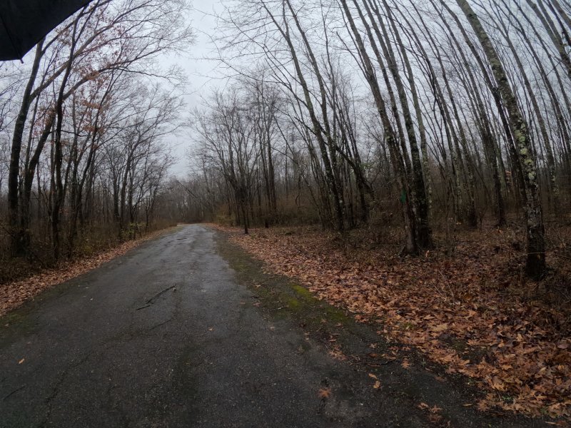
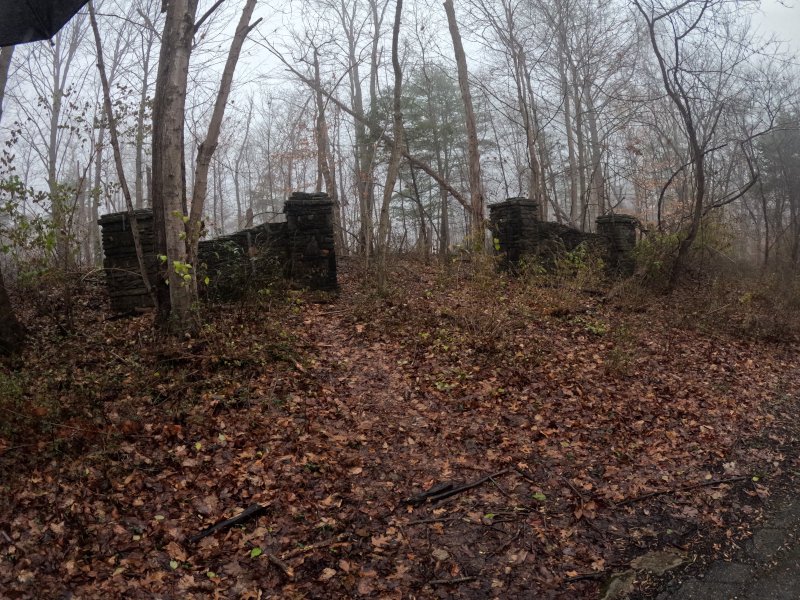
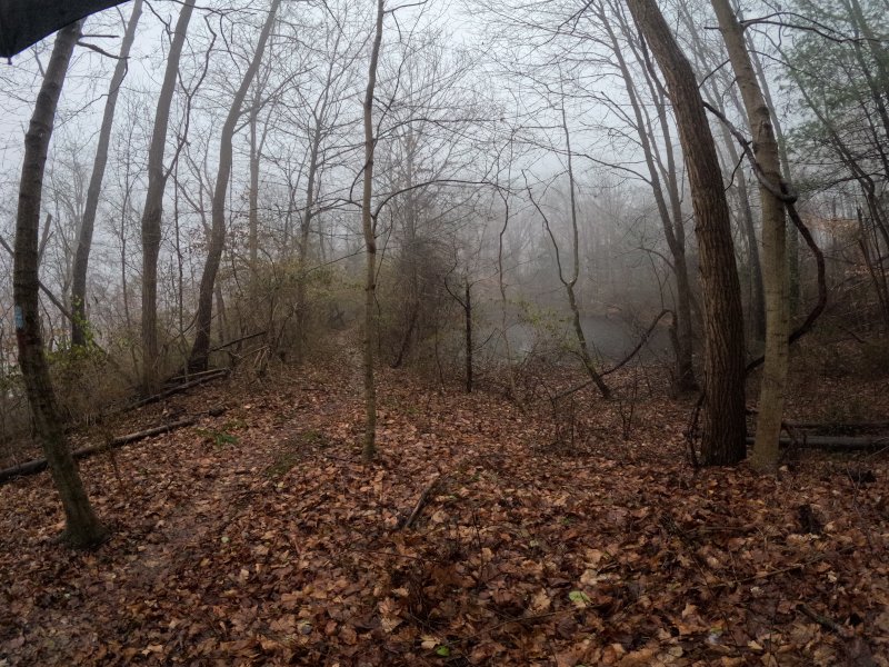
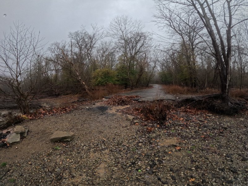
After parking in the small gravel lot, take the old road that is closed by an orange chain. This is noted on maps as EFSP Trail (East Fork State Park Trail) and was once where the old Williamsburg-Bantam Road continued until the stream was dammed. Follow the old road about 0.4 miles until it begins to work down the hill. The arches will be easily seen on the left, remnants of a gate for a home and property. Hikers can continue along a makeshift trail through the arches, passing a pond. However, it is probably less easy to access seasonally due to brush. Other than old fences, very little remnants of its past still exist. This property has been called the Achley farmstead and the Wilson property.
To get to the shore and a haunting view of the road to nowhere, continue along the old Williams-Bantam Road.
Hiking the Road to Nowhere

Loveland Frogman
The Loveland Frogman was a short-lived legend in southwestern Ohio, where a frog-like creature showed up at doorsteps, along the…

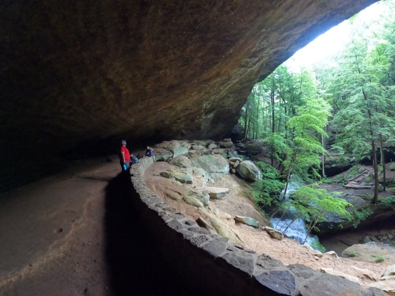
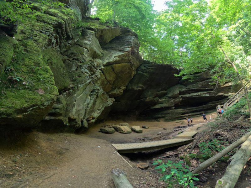
Old Man’s Cave
Among the stunning hiking areas in the enchanting Hocking Hills, Old Man’s Cave emerges as a premier destination that captivates…

Oh, The Legends
John “Appleseed” Chapman, the legendary figure known for planting apple trees across Ohio, frequently traveled through the Mohican Gorge on…
Nearby Hiking Trails at East Fork State Park:
Prairie Trail 0.5 miles, easy. Loop.
Park Road 3
Bethel, OH 45106
Parking: (39.012350, -84.138356)
Steven Newman Worldwalker Perimeter Trail — 30.1 miles, moderate; multi-use for horses, hikers, and backpackers. Access and parking on the north side of the Perimeter Trail are available at the campground visitor parking lot. Trail named after the famous world walker from Bethel, Ohio. Five overnight areas are provided. All backpackers must register for overnight areas. Trailhead: (39.00531, -84.13581)
Camp 1 (39.006806, -84.134755)
Camp 2 (38.992670, -84.106030)
Camp 3 (38.998056, -84.074583)
Camp 4 (39.051028, -84.115778)
Camp 5 (39.020495, -84.162288)
The trail is marked in green blazes. Some of the trail is shared with the Buckeye Trail, so you may see blue blazes in some sections. May be muddy as shared with horse riders.
Storybook Trail 0.5 mile, moderate (not wheelchair/stroller friendly).
Near Beach Pavilion
Off Park Road 2
Bethel, OH 45106
Parking: (39.017261, -84.132913)
North side of lake:
Fern Hill Loop Trail — 1.4 miles, moderate
Loop K
Batavia, OH 45103
(39.028959, -84.094902)
Mountain biking permitted. It takes about 30 minutes to hike. This is a popular trail for birding, hiking, and exploring. Dogs must be on a leash. This is a fee area from Memorial Day through Labor Day and during special events
Whippoorwill Trail
In the East Fork Campground Check-in right before the booth 0.6 miles, easy loop
Batavia
Ohio 45103
(39.047365, -84.102974)
It takes about 15 minutes to hike. Dogs are allowed, but must be on a leash.
Williamsburg-Batavia Hike Bike Trail — 6 miles. Begins at the end of Old Broadway Road in Williamsburg and follows Williamsburg-Bantam Road through the East Fork Wildlife Area. After crossing Kain Run Creek via bridge, the trail winds to a scenic overlook along the edge of the lake. From there, the trail proceeds to the campground area and connects to the main campground road. The trail continues to follow the main park road and eventually connects to Zagar Road in Batavia Township.
For other locations and mileage: There are several locations throughout the Village to “park and ride” for Hike/Bike Trail visitors:
- Harmony Hill at 299 S. Third
- Williamsburg “Old” High School at 549 W Main
- Community Parking Lot at 285 W. Main
- Village Offices (Community Center) at 107 W Main
- Williamsburg Community Park at 150 E Main
West side of lake by US Army Corps property:
Deer Ridge Trailhead 0.5 miles, easy. Takes about 10-15 minutes.
2185 Slade Road
Batavia, OH 45103
(39.025000, -84.145157) Located across from the US Army Corps of Engineers Visitors Center off Slade Road.
Tailwater — 2 miles, moderate. Located below the dam.
Backpack Trail — 16 miles, moderate, Red blazes. It is a challenging hike through oak-hickory forest and old fields. Trail starts at South Trailhead.
Mountain Bike Trails -10 plus miles, easy to moderate. There are four trails through woods starting from the South Trailhead. Bikers yield to hikers.
Bridle Trails – 22 miles, easy to moderate. Five different trails can be accessed from the Horse Activity/North Trailhead Lot off of Park Road 4. Hikers should yield to horseback riders when hiking on horse and multi-use trails.