Maumee Bay Trail: The View May Not Be the only Treasure There
Maumee Bay State Park is situated on land that once formed part of the expansive Great Swamp, an area transformed by early settlers who drained its wetlands for agriculture. Over time, this region evolved into a quaint community of vacation cottages known as Niles Beach, which faced near obliteration from fierce storms in 1972. The destructive forces of nature compelled many owners to abandon their dreams of rebuilding. In the mid-1970s, the state of Ohio recognized the land’s potential and acquired it, transforming it into a state park. Today, visitors can enjoy a lodge, charming cottages, well-equipped camping facilities, and a picturesque beach.
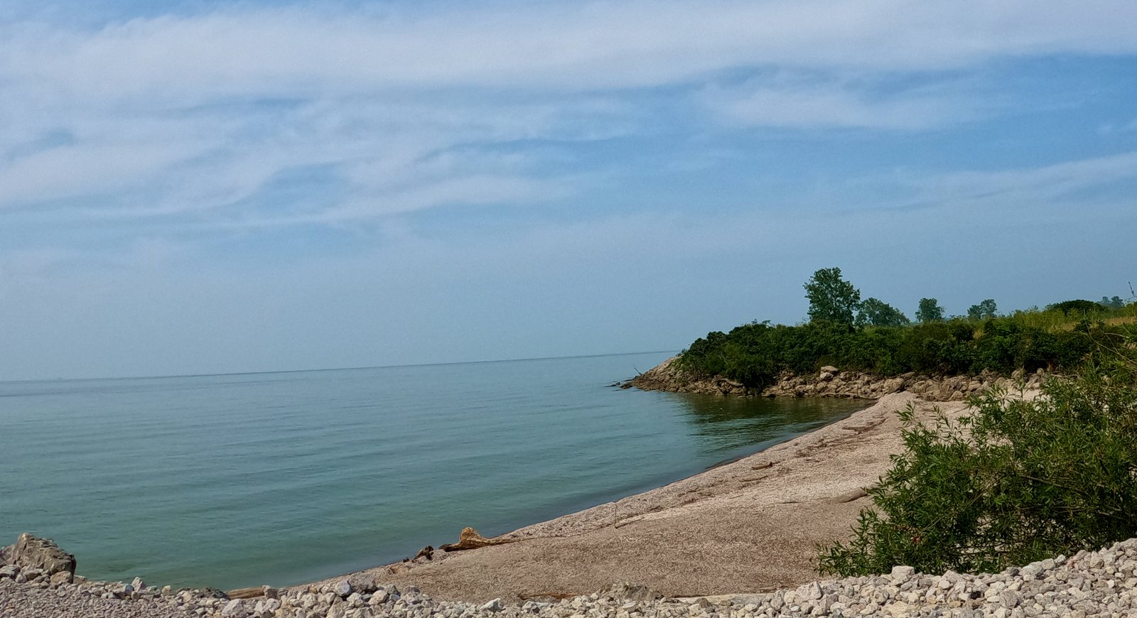
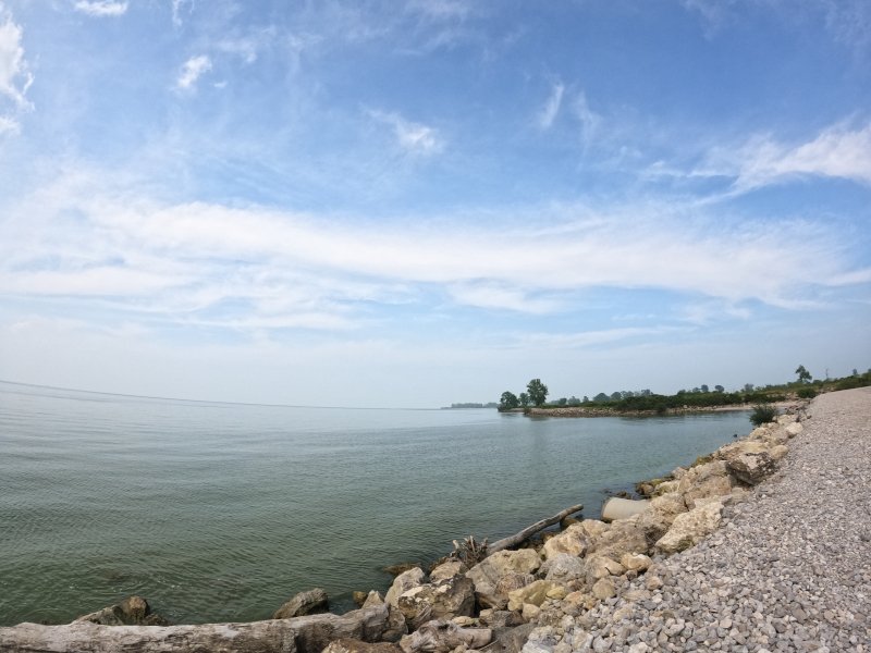
Shhh. A nearly concealed trail, some would say is secret, meanders along an old service road within Maumee Bay State Park, leading adventurers through an estuary brimming with a rich tapestry of wildlife. This path hugs the shoreline of a protective breakwater, offering stunning vistas of Lake Erie that inspire awe. The tranquility of the trail provides a serene escape from the bustling beach crowds, inviting solitude and reflection. Those familiar with the area remember the tumultuous nature of the lake, where water can surge violently during fierce storms. The weather here is notoriously unpredictable; its combination of shallow depths and vast openness allows strong winds to generate towering waves that stir sediments from the lakebed and hurl them against the shore.
This tumultuous stretch of water has claimed countless vessels, with over 2,000 ships sinking in the depths of Lake Erie, including around 600 within Ohio’s waters—marking one of the highest concentrations of shipwrecks globally. Many will likely never be found, and the final moments alive for the crews will remain a mystery for all time. Many of these maritime tragedies have left ships and their crews to vanish into the abyss. Occasionally, fragments of their lost existence wash ashore, serving as haunting reminders of their fates. While it remains a mystery whether these remnants once held treasures of gold or silver, each piece acts as a historical artifact, beckoning to be explored and potentially unlocking the secrets of ships that have faded from memory, lost to the depths without a trace.
Parking/Trailhead
Maumee Bay Estuary Trail
Maumee Bay State Park Lodge/Cabins Park Road 3
Oregon, OH 43616
(41.678129, -83.352208)
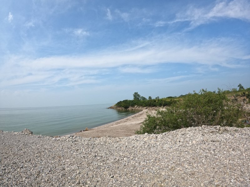
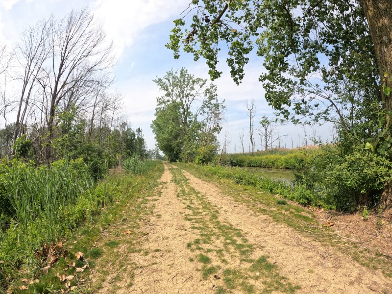
Hike old roads to a quiet beach and along the way, explore woodland/marsh trails and observation decks. Hikers park at the old Cedar Point entrance near the Sawmill Creek Resort, a small lot near the trail. If facing US-6 and the historical sign, go left toward the pedestrian-only service road (the car exit) and make another left to the old roadway. Hikers follow the old road (there will be dirt paths and trails to the left along the way), and when it ends, take a right on the intersecting roadway. This route takes hikers past two observation decks and eventually to a sand trail/walkway that leads to the beach. From the parking area, about 0.8 miles one-way. Hikers can also explore the beach until it turns into private property marked with signs.
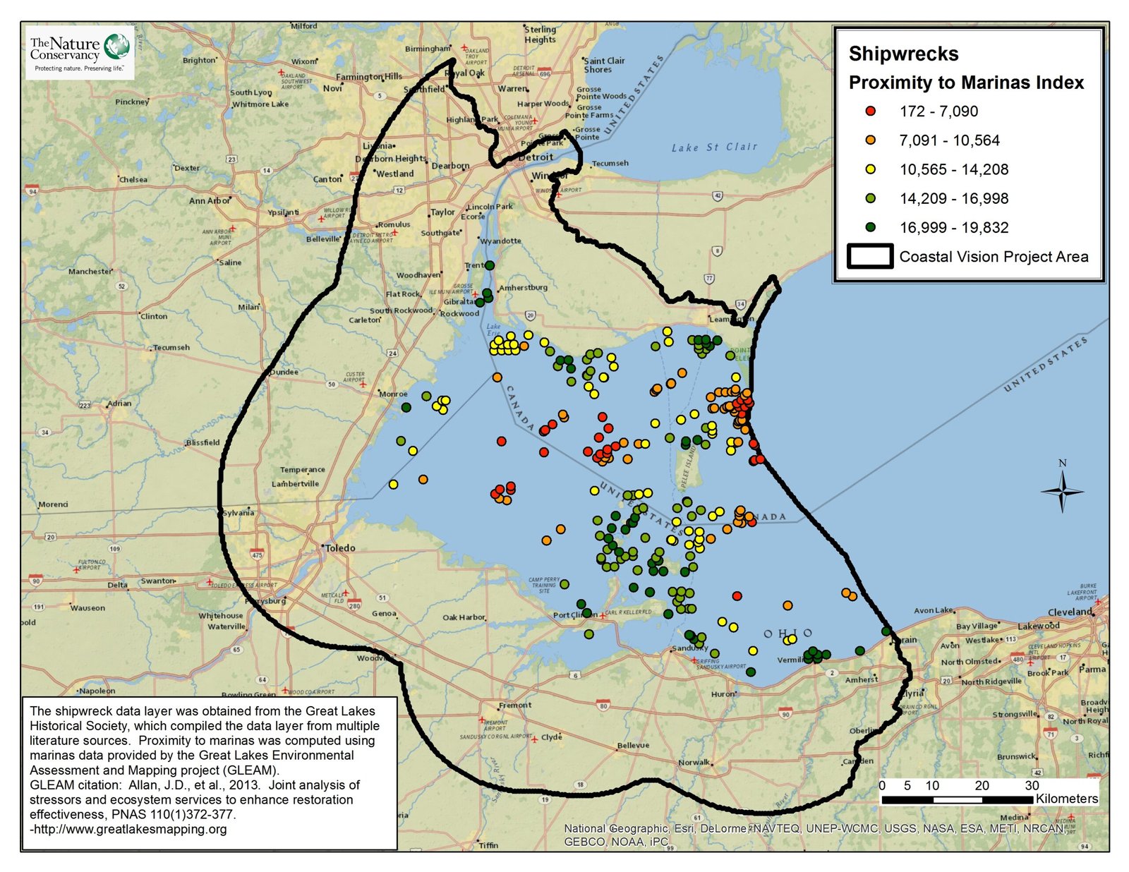
This data layer shows shipwreck locations in relation to marinas throughout the Western Lake Erie Basin (WLEB). In the analysis, the shipwrecks included in this layer were valued according to their proximity to marinas, with the assumption that wrecks closest to marinas will have the greatest value to local economies. The shipwreck data layer was obtained from the Great Lakes Historical Society, which compiled the data layer from multiple literature sources (received . The marinas layer was compiled by the Great Lakes Environmental Assessment and Mapping Project (GLEAM) and used for the valuation of individual shipwrecks.
Hiking the Trail
Loveland Frogman
The Loveland Frogman was a short-lived legend in southwestern Ohio, where a frog-like creature showed up at doorsteps, along the…
Old Man’s Cave
Among the stunning hiking areas in the enchanting Hocking Hills, Old Man’s Cave emerges as a premier destination that captivates…
Oh, The Legends
John “Appleseed” Chapman, the legendary figure known for planting apple trees across Ohio, frequently traveled through the Mohican Gorge on…
Nearby Visits:
Fairport Harbor Lighthouse: Nestled along the picturesque shores of Lake County, Fairport Harbor Lighthouse stands tall as a radiant beacon of safety, guiding countless ships and sailors through the treacherous waters of the Great Lakes.
Headlands Beach-Ohio’s longest beach
Johnson’s Island– Confederate Civil War Cemetery.
Maumee Bay State Park– Maumee Bay State Park is a popular destination known for its scenic beauty and recreational opportunities. The park features a variety of outdoor activities, including hiking, boating, and birdwatching, making it an ideal spot for nature enthusiasts. Visitors can enjoy picturesque views of Maumee Bay and the diverse wildlife that inhabits the area.
Kelleys Island and Middle Bass Island, nestled amidst the shimmering expanse of Lake Erie, have long captivated the imaginations of locals and visitors alike with their legendary tales of mysterious lights.
Cedar Point is a 364-acre amusement park located on a Lake Erie peninsula in Sandusky, Ohio owned and operated by Six Flags. Features a private mile-long beach. It opened in 1870 and is considered the second-oldest operating amusement park in the US. Cear Point is the largest amusement ride park in the world as it offers over 150 rides (including 17 roller coasters), shows, and attractions.
The African Safari Wildlife Park is a drive through wildlife park in Port Clinton, Ohio. Visitors can drive through the 65-acre preserve and watch and feed the animals from their car.
The Watering Hole – Ohio Safari Zoo and Waterpark is an indoor/outdoor family fun center with waterslides, a go-kart track, an arcade & a mini-golf course.
Catawba Island State park near Port Clinton serves as the main headquarters for the Lake Erie Islands state parks (including Kelleys Island, South Bass and Oak Point), and provides a fishing pier, launch ramp, picnic shelter and picnic areas for day-use visitors
Magee Marsh Wildlife Area, west of Port Clinton, is one of the state’s foremost birding areas and is notable for its spring and fall bird migrations
East Harbor State Park on Marblehead Peninsula sports the largest campground in the Ohio state park system • Swimming, picnicking, boating and fishing are popular at East Harbor
Marblehead Lighthouse, built in 1821, is the oldest lighthouse in continuous operation of the Great Lakes and Ohio’s 73rd state park • It is located off S.R. 163 on the east side of the Village of Marblehead
Ohio State nature preserves located in the area include Sheldon Marsh, Old Woman Creek, Erie Sand Barrens, and DuPont Marsh
For more information on area attractions, visit
Lake Erie Shores & Islands Welcome Center(s)
South Bass Island (Put in Bay) South Bass Island is renowned for its stunning natural beauty, vibrant community, and rich history. The island boasts picturesque landscapes featuring lush green parks, scenic waterfronts, and breathtaking views of Lake Erie. Visitors can explore charming shops and local eateries in the quaint village of Put-in-Bay, which serves as a hub for tourists.
Additionally, the island offers a variety of recreational activities, including boating, hiking, and fishing, making it a popular destination for outdoor enthusiasts. Historically significant sites, such as the Perry’s Victory and International Peace Memorial, also highlight the island’s importance in American history. Overall, South Bass Island is a captivating spot for those seeking adventure, relaxation, and a glimpse into the region’s past.
Click here for Ferries to Middle Bass and Put in Bay
If you don’t have your own boat, 2 privately operated ferries offer frequent daily service:
For more detailed info about Miller Ferry, please click here!
Miller Boat Line offers service for cars, RVS, bicyclists, & pedestrians from the mainland at Catawba • visit www.millerferry.com or call 800-500-2421 for information
The Jet Express offers service for pedestrians from Port Clinton and Sandusky • visit www.jet-express.com or call 800-245-1538 for information
