Clermont County’s Gold Rush of 1868
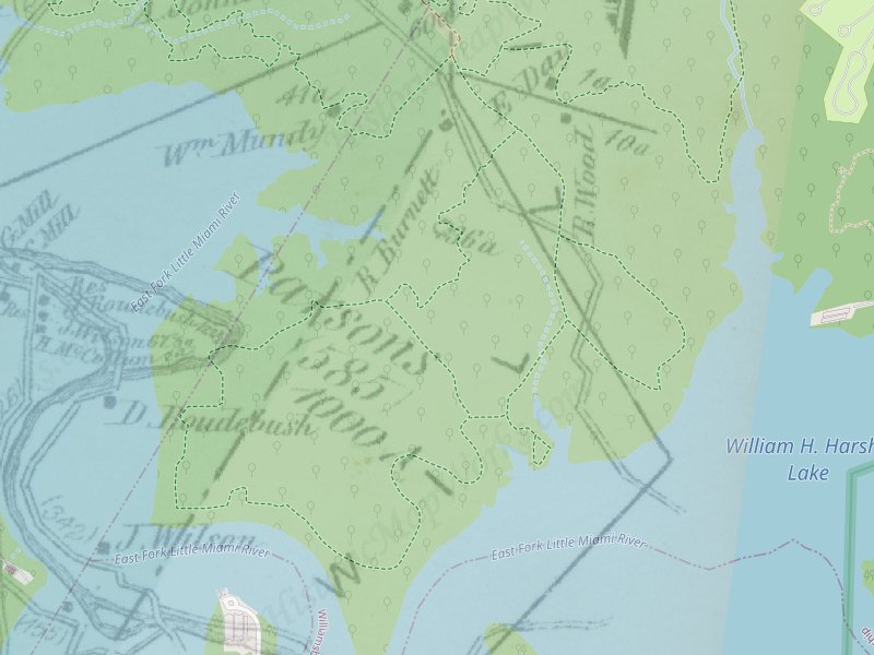
In the year 1869, Clermont County was home to a couple of fledgling gold mines, one nestled near Twin Bridges and the other in proximity to Elk Lick. These ventures, however, were short-lived spectacles of hope. The initial discovery of gold occurred on the land owned by Robert Wood, a local farmer residing close to Elk Lick. Today, the remnants of Elk Lick lie submerged beneath the tranquil waters of William H. Harsha Lake, a poignant reminder of the past, as its inhabitants were compelled to abandon their beloved homes to make way for the construction of the dam and reservoir.
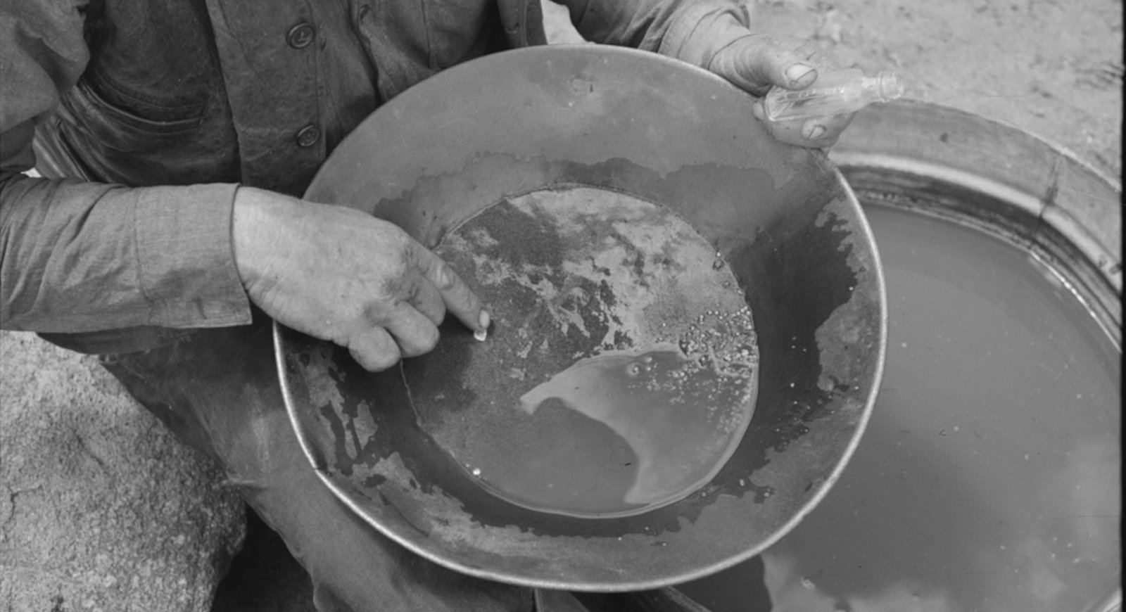
During the bustling days of the gold rush, a rudimentary flume was employed to wash gravel, revealing the elusive golden flakes hidden within. Yet, this industrious operation endured for less than a year. The harsh reality set in as prospectors realized that the costs associated with mining the sparse quantities of gold far exceeded any potential yield. Most of the precious metal had already been carried away southward by the glaciers that once carved the landscape. Despite this historical setback, a determined band of modern-day prospectors still venture into the local creeks in search of fortune, armed with nothing but their pans and aspirations, though none have yet managed to strike it rich. Here’s an Ohio Geology Newsletter with some fascinating information.
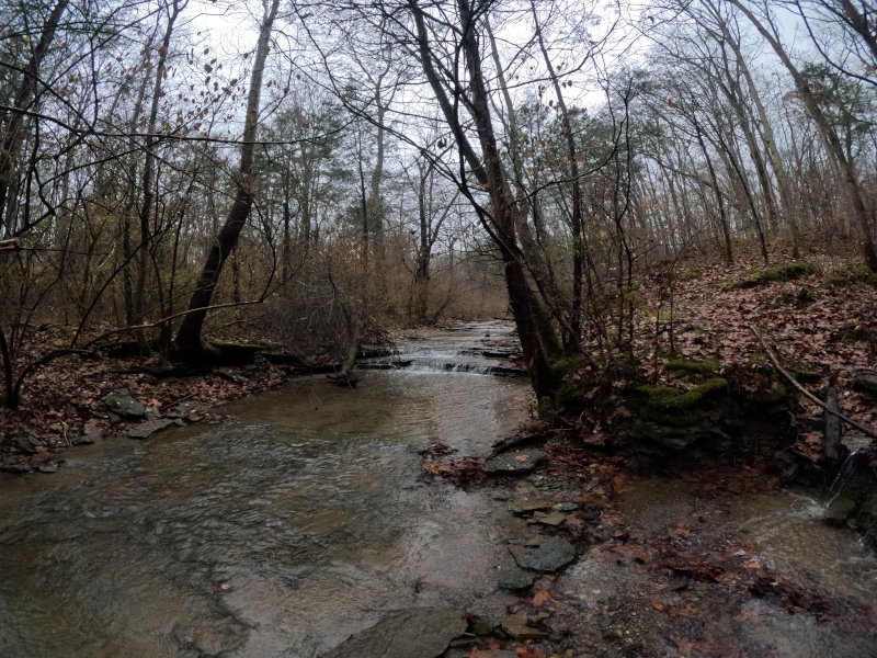
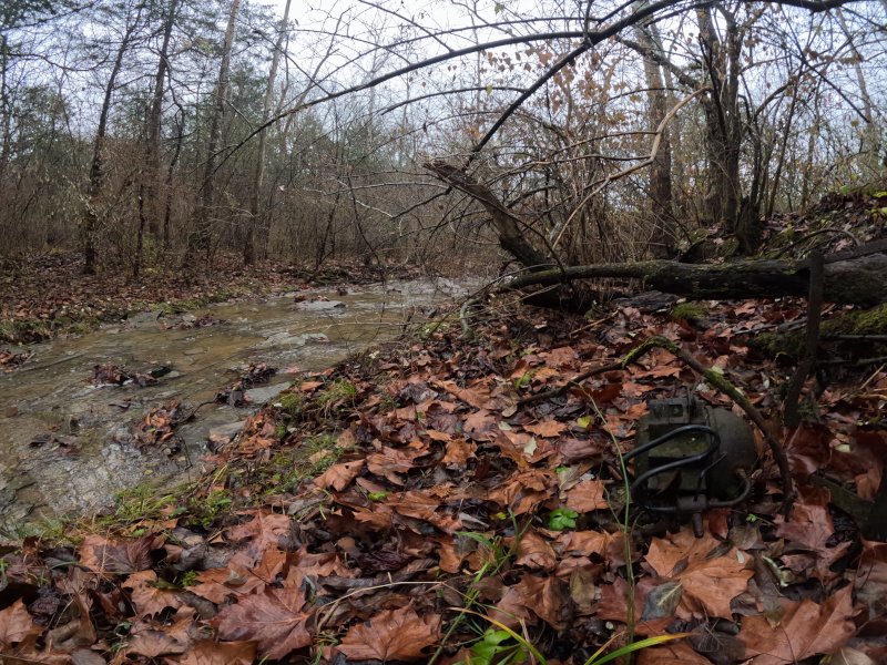
Historic creek where gold was panned
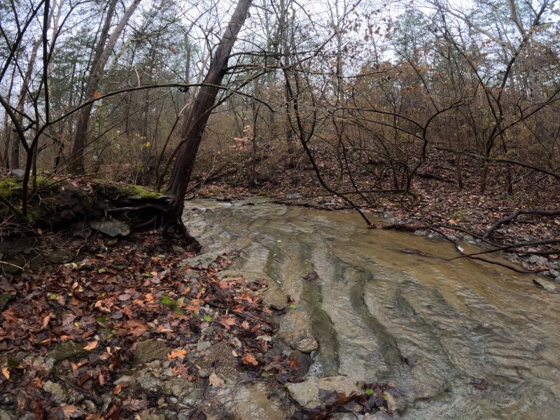
Cabin Run Creek
Gold can still be found in the glaciated regions of Ohio. Don’t get excited; it has never made anyone rich. The gold discovered in Ohio is primarily placer gold, which comes in the form of dust, flakes, or nuggets. These can be found through creek panning or sluicing. Prospecting for gold as a hobby does not require a permit from the State of Ohio, as long as the activity is recreational, the gold collected is of little or no commercial value, and there are no adverse impacts on the environment. And it is done on property which allows it.
It is necessary to obtain permission from the state or private landowners before you begin. Some notable gold panning sites in Ohio include Stonelick Creek and Brushy Fork in Clermont County.
You cannot pan for gold at East Fork or Lake Harsha; it is against park regulations. However, you can hike the banks of Cabin Run Creek where small amounts of gold were once found and take in the history of the area. A man named John Allen operated a drift mine on Cabin Run in the 1920s, although it was short-lived. Fishermen today, when talking about great places to fish, go to Gold Mine Hollow where Cabin Run Creek flows into Lake Harsha.
Where can you access Cabin Run Creek?
Parking can be accessed at the campground office:
(39.047498, -84.102678)
The Whippoorwill Trail at the far side of the Campground Parking Area (39.047436, -84.102994) comes alongside the creek. At the first intersection, take a right for quicker access.
There is a horse trail access at the far end of East Fork State Park Horse Camp marked as BRIDLE TRAIL Loop C Marked as A (1-17) The trail can be muddy, but it leads down to the creek.
(39.042162, -84.100372)
There is no parking here for the horse trail access.
Parking can be accessed at the campground office:
(39.047498, -84.102678)
Cabin Run Creek

Loveland Frogman
The Loveland Frogman was a short-lived legend in southwestern Ohio, where a frog-like creature showed up at doorsteps, along the…

Old Man’s Cave
Among the stunning hiking areas in the enchanting Hocking Hills, Old Man’s Cave emerges as a premier destination that captivates…

Oh, The Legends
John “Appleseed” Chapman, the legendary figure known for planting apple trees across Ohio, frequently traveled through the Mohican Gorge on…
Nearby Hiking Trails at East Fork State Park:
Prairie Trail 0.5 miles, easy. Loop.
Park Road 3
Bethel, OH 45106
Parking: (39.012350, -84.138356)
Steven Newman Worldwalker Perimeter Trail — 30.1 miles, moderate; multi-use for horses, hikers, and backpackers. Access and parking on the north side of the Perimeter Trail are available at the campground visitor parking lot. Trail named after the famous world walker from Bethel, Ohio. Five overnight areas are provided. All backpackers must register for overnight areas. Trailhead: (39.00531, -84.13581)
Camp 1 (39.006806, -84.134755)
Camp 2 (38.992670, -84.106030)
Camp 3 (38.998056, -84.074583)
Camp 4 (39.051028, -84.115778)
Camp 5 (39.020495, -84.162288)
The trail is marked in green blazes. Some of the trail is shared with the Buckeye Trail, so you may see blue blazes in some sections. May be muddy as shared with horse riders.
Storybook Trail 0.5 mile, moderate (not wheelchair/stroller friendly).
Near Beach Pavilion
Off Park Road 2
Bethel, OH 45106
Parking: (39.017261, -84.132913)
North side of lake:
Fern Hill Loop Trail — 1.4 miles, moderate
Loop K
Batavia, OH 45103
(39.028959, -84.094902)
Mountain biking permitted. It takes about 30 minutes to hike. This is a popular trail for birding, hiking, and exploring. Dogs must be on a leash. This is a fee area from Memorial Day through Labor Day and during special events
Whippoorwill Trail
In the East Fork Campground Check-in right before the booth 0.6 miles, easy loop
Batavia
Ohio 45103
(39.047365, -84.102974)
It takes about 15 minutes to hike. Dogs are allowed, but must be on a leash.
Williamsburg-Batavia Hike Bike Trail — 6 miles. Begins at the end of Old Broadway Road in Williamsburg and follows Williamsburg-Bantam Road through the East Fork Wildlife Area. After crossing Kain Run Creek via bridge, the trail winds to a scenic overlook along the edge of the lake. From there, the trail proceeds to the campground area and connects to the main campground road. The trail continues to follow the main park road and eventually connects to Zagar Road in Batavia Township.
For other locations and mileage: There are several locations throughout the Village to “park and ride” for Hike/Bike Trail visitors:
- Harmony Hill at 299 S. Third
- Williamsburg “Old” High School at 549 W Main
- Community Parking Lot at 285 W. Main
- Village Offices (Community Center) at 107 W Main
- Williamsburg Community Park at 150 E Main
West side of lake by US Army Corps property:
Deer Ridge Trailhead 0.5 miles, easy. Takes about 10-15 minutes.
2185 Slade Road
Batavia, OH 45103
(39.025000, -84.145157) Located across from the US Army Corps of Engineers Visitors Center off Slade Road.
Tailwater — 2 miles, moderate. Located below the dam.
Backpack Trail — 16 miles, moderate, Red blazes. It is a challenging hike through oak-hickory forest and old fields. Trail starts at South Trailhead.
Mountain Bike Trails -10 plus miles, easy to moderate. There are four trails through woods starting from the South Trailhead. Bikers yield to hikers.
Bridle Trails – 22 miles, easy to moderate. Five different trails can be accessed from the Horse Activity/North Trailhead Lot off of Park Road 4. Hikers should yield to horseback riders when hiking on horse and multi-use trails.